{{ alert.message }}
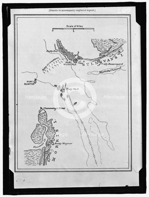
Map showing Fort Sumter and Fort Moultrie, between 1909 and 1914. Creator: Harris & Ewing.
2-917-374 - Heritage Art/Heritage Images
Map showing Fort Sumter and Fort Moultrie, between 1909 and 1914. 'Drawn to accompany engineer report'. Battle site, Charleston Harbour, South Carolina: Battery Bee, rope obstructions, Sullivan's Island, Maffitt's Channel, buoys, Cumming's Point, Vincent's Creek, Morris Island, Battery Wagner.
Image Details
People Information
Creator
- Harris & Ewing, attributed to: American: Photographer, photography company, photography studio
People Related
- Martha Ewing: American: Photographer
- George W. Harris: British; American: Photographer
Geographic Hierarchy
World North and Central America United States South Carolina Charleston Charleston
- 32 46 00 N , 079 55 00 W
Category Hierarchy
History & Politics War & Military Wars, Battles & Events
Science & Nature Geographical Features
Digital Image Size
Pixel Dimensions (W x H) : 7741x10235
File Size : 77,373kb
Aliases
- 2016852948
- 1010014386
- 2-917-374
- 2016852948
- 2917374