{{ alert.message }}
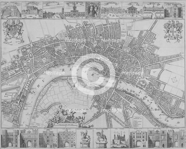
Map of the Cities of London and Westminster and Southwark, 1690. Artist: Anon
1-619-836 - The London Archives (City of London)/Heritage Images
Map of the Cities of London and Westminster and Southwark, 1690. With views of buildings and portraits of William III and Mary II in an oval in the top margin and gates, the Tower of London and statues of Charles I and Charles II in the lower margin.
Image Details
People Information
Creator
- Anon, attributed to: :
Subject
- King William III: Dutch; British: King of England, Prince of Orange, stadtholder
- Queen Mary II: British; English: Queen of England
- King Charles II: British: King of Great Britain and Ireland
- King Charles I: British; English: King of England and Scotland
Geographic Hierarchy
World Europe United Kingdom England Greater London London
- 51 30 51 N , 000 05 35 W
World Europe United Kingdom England Greater London London City of Westminster Westminster
- 51 29 09 N , 000 08 01 W
World Europe United Kingdom England Greater London London City of London
- 51 30 51 N , 000 05 37 W
World Europe United Kingdom England Greater London London Southwark Southwark
- 51 30 00 N , 000 05 00 W
Digital Image Size
Pixel Dimensions (W x H) : 2803x2248
File Size : 18,461kb
Aliases
- 30636
- k1238749
- 0220004472
- 1-619-836
- 1619836
- 30636