{{ alert.message }}
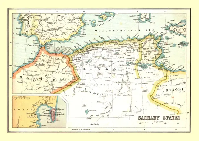
Map of the Barbary States, 1902. Creator: Unknown.
2-697-176 - The Print Collector/Heritage Images
Map of the Barbary States, 1902. Showing Morocco, Algeria, Tunisia, and Libya on the North African coast, with inset of Gibraltar. From The Century Atlas of the World. [John Walker & Co, Ltd., London, 1902]
Image Details
People Information
Creator
- Unknown, attributed to: :
People Related
- Edinburgh Geographical Institute: Scottish, British: Geographical Institute
Geographic Hierarchy
- 25 00 00 N , 017 00 00 E
World Oceans Mediterranean Sea
- 35 00 00 N , 020 00 00 E
- 32 00 00 N , 005 00 00 W
- 28 00 00 N , 003 00 00 E
- 34 00 00 N , 009 00 00 E
- 36 00 00 N , 006 30 00 E
Digital Image Size
Pixel Dimensions (W x H) : 4850x3432
File Size : 48,766kb
Aliases
- 2B
- 0580054154
- 2-697-176
- 2697176