{{ alert.message }}
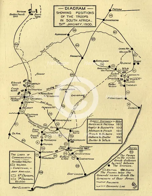
'Diagram Showing Positions of the Troops in South Africa, 31st January 1900', (c1900). Creator: Unknown.
2-979-874 - The Print Collector/Heritage Images
'Diagram Showing Positions of the Troops in South Africa, 31st January 1900', (c1900). Boer Wars. Map showing lines of communication and the positions of the British and the Boers: 'The figures in the circles denote distances by rail between the stations...The Figures below the Generals' names denote the strength of their force [ie numbers of soldiers]'. From "Cassell's History of England, Vol. IX". [Cassell and Company, Limited, London, Paris, New York & Melbourne]
Image Details
People Information
Creator
- Unknown, attributed to: :
People Related
- Cassell & Co: : Publisher, printer, lithographer, publishers, printers, lithographers
Digital Image Size
Pixel Dimensions (W x H) : 4116x5309
File Size : 64,020kb
Aliases
- 0580086084
- 2-979-874
- 2979874