{{ alert.message }}
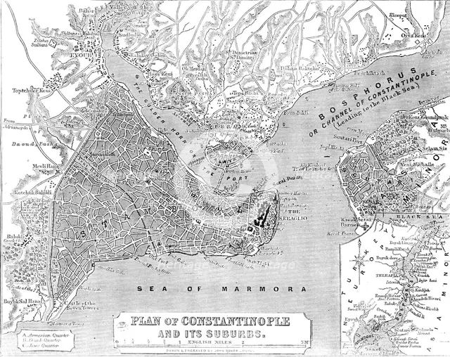
Plan of Constantinople and its Suburbs, 1856. Creator: John Dower.
2-969-990 - /Heritage Images
Plan of Constantinople and its Suburbs, 1856. Map showing the city of Constantinople (modern Istanbul, Turkey), including the 'Golden Horn or the Port'; the Bosphorus 'or Channel of Constantinople, leading to the Black Sea'; the Sea of Marmora, the 'Armenian, Frank and Jews' Quarters, pontoon bridge and the Seraglio. From "Illustrated London News", 1856.
Image Details
People Information
Creator
- John Dower, attributed to: English, British: Engraver, artist, printmaker, mapmaker, print seller, publisher
Geographic Hierarchy
World Asia Turkey İstanbul Istanbul
- 41 00 40 N , 028 57 28 E
World Asia Turkey İstanbul Bosporus
- 41 03 26 N , 029 02 36 E
Category Hierarchy
History & Politics War & Military Wars, Battles & Events
Science & Nature Geographical Features
Digital Image Size
Pixel Dimensions (W x H) : 3607x2863
File Size : 10,085kb
Aliases
- ILN_1856_Page_360_a.jpg
- 1856
- 0580080168
- 2-969-990
- 2969990