{{ alert.message }}
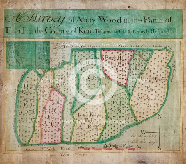
Map of Abbey Wood, part of Erith or Lesnes Manor on the eastern boundary of Woolwich, Kent, 1791. Artist: Anon
2-502-648 - The London Archives (City of London)/Heritage Images
Map of Abbey Wood, part of Erith or Lesnes Manor on the eastern boundary of Woolwich, Kent, 1791. The map shows field names and acreages.
Image Details
Geographic Hierarchy
World Europe United Kingdom England Greater London London Greenwich Greenwich
- 51 29 00 N , 000 00 00 E
World Europe United Kingdom England Greater London Bexley Erith
- 51 29 00 N , 000 11 00 E
World Europe United Kingdom England Greater London Bexley Abbey Wood
- 51 29 00 N , 000 08 00 E
Digital Image Size
Pixel Dimensions (W x H) : 3452x3046
File Size : 30,806kb
Aliases
- 22787
- q9517147
- 0220007332
- 2-502-648
- 22787
- 2502648