{{ alert.message }}
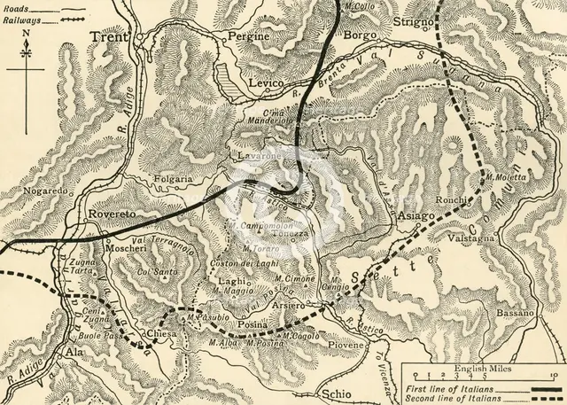
'Map illustrating the Austrian Attack in the Trentino, May, 1916', (c1920). Creator: Unknown.
2-752-195 - The Print Collector/Heritage Images
'Map illustrating the Austrian Attack in the Trentino, May, 1916', (c1920). Italian and Austrian lines in northern Italy during the First World War. From "The Great World War: A History", Volume VI, edited by Frank A Mumby. [The Gresham Publishing Company Ltd, London, c1920]
Image Details
People Information
Creator
- Unknown, attributed to: :
People Related
- Frank Arthur Mumby: : Author, writer, journalist, historian, editor
- Gresham Publishing Company: : Publishers, publisher
Digital Image Size
Pixel Dimensions (W x H) : 5440x3887
File Size : 61,950kb
Aliases
- 0580067625
- 2-752-195
- 2752195